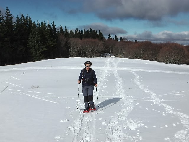
Sunday, 6 April 2014

Crossing the Hardangervidda

Hardangervidda, Norway. The largest mountain plateau in Europe. 6,500 km2 of barren landscape, covered in snow for half of the year. Roald Amudsen and Fridtjof Nansen practised for their polar exploits here.
I used to have the dream of crossing Greenland, but as it starts to look that will never happen, I settled for crossing the Hardangervidda as a consolation prize.
In the Spring of 2014 we made it: we crossed Hardangervidda on skis, from Haukelisetter to Eidfjord. This is a short diary of our tour.

Saturday, 29th of March: Turnhout to Bergen. 
The first challenge Hardangervidda presented us was how to get there. On Saturday we flew from Amsterdam to Bergen. It is always strange to arrive in a city you know but not that well. Fortunately Bergen is small and we could remember enough of the city to find the way from the bus station to our lodging for the night, the delightful Steens hotel.
Steens Hotel is an old house of the old Bergen gentry. Just the breakfast room is worth a visit.
Sunday, 30th of March: Bus Ride to Haukeliseter
Beautiful scenery along the fjords of Western Norway, including a ferry crossing.
Beautiful fjord view on the way to Hakelisetter.
Suddenly the road becomes steep with switch-backs and immediately the landscape changes from fjords to snow covered hills. We are arriving to Hardangervidda.
We have very fond memories of Haukeliseter, where we spent a week eight years ago, when we were just staring to discover Norway. It was a pleasant coincidence that we were lodged in the same building as before.
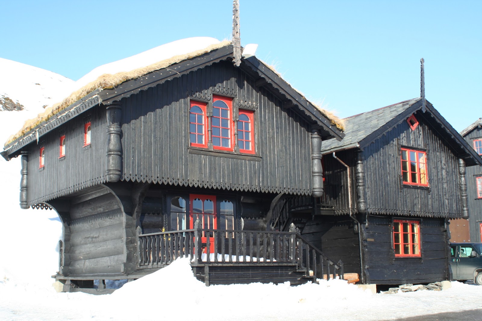
Photo of the building where we were lodged... taken in 2006. 
Sunday afternoon was spent enjoying the sunshine skiing around the lodge.
Warming up for the tour about to start.
Monday, 31st of March: Haukeliseter to Hellevassbu (25km)
The first leg of the tour was one of the longest. To make it worse, it starts with a steep climb on icy snow to which neither skins nor edges seems to grip. We had to carry the skis for a while.
At the top we started to follow the marked path... until it turned west and we saw the road in front of us again. So, go back and find an unmarked route. We were not the only ones to be fooled: two Brits who were doing the same route made the same mistake.
More steep climbing (now the skins held) and we find path markings again. All is well, the terrain becomes easier and the snow softens under the warm sunshine.
Short break on the way to Hellevassbu

At Hellevassbu we were welcome by four Norwegians who had arrived earlier from the North.
Cosy Hellevassbu
Tuesday, 1st of April: Hellevassbu to Litlos (20 km)
Another bright, sunny day. After the initial climb out of the lake the terrain was easy. Except the descent to a lake just before the hut, which provided the Skipper the opportunity to perfect his technique of head-plant.
On the way we crossed some skiers going the opposite way who told us that there was no gas in the cabin. However, when we approached Litlos we saw the guardians were already there preparing for the opening of the staffed lodge next day. They changed the gas bottle and also allowed some people to sleep in the main building when the small self-service cabin was full to capacity.

Wednesday, 2nd of April: Litlos to Sandhaug (26 km)
Thanks to the glorious weather, the tour is going well... too well. If we continue heading North we risk reaching the end too early. So we decided to make a little detour to the West, to Sandhaug.
For the first time in this tour the day started cloudy, but dry and with little wind. The day starts again with a climb, before it becomes easier.
Around here, ptarmigans seem absolutely unafraid of people.
Tea-break.
It is 21 km to a closed, private lodge (Besso) and then five more to Sandhaug. At the first hut we were starting to feel the distance, so decided to stop for a break before continuing. As we went around the lodge to find a sheltered corner we noticed there were people in the lodge. Then we saw the writing above the door: Sandhaug. Hey, we're there! We seem to have missed Besso and almost passed by our destination.
The lodge was staffed, so we could have shower and proper dinner and breakfast.  Utmost luxury!

Thursday, 3rd of April: Sandhaug to Hadlaskard (21 km)
The bright sunshine has returned and we had a beautiful, easy tour to Hadlaskard, with the perfect shape of Hårtegen always in view.
On the way to Hadlaskard, with Hårtegen in the background.
The final descent toward the cabin was marvellous, with soft snow, gentle incline, and plenty space to traverse the steep bits.
View from Hadlaskard to the South.
We seem to be a bit off the beaten track, so we had the cabin for ourselves. The draw back is that we had to do all the work of carrying wood and snow, keep the fire going, clean, and all the other chores of staying in self-serviced cabins.
Cosy evening in the cabin
The night was clear and cold. When I went out, the sky was so full of starts that almost made me dizzy from looking into the infinite. So sad that living in a crowded, light-polluted place I had forgotten what the night sky is supposed to look like... 

Friday, 4th of April: Hadlaskard to Garen (26 km)
A chilly SE wind and mare's tails in the sky announce a change of weather. Anyway, it is our last day as we are heading to Garen on the road.
Passing Hedlo, on the way back to civilisation.
The route was not marked and having to find our way added interest to the tour, which was easy until the village of Vivelid. After that it goes steeply up (skins) and passes near the end of the incredibly steep Eidfjord.
Than steeply down for a while along a snow-scooter track with switch-backs and icy snow (we walked most of this bit), up again and finally a looooong flat stretch before the final descent along the groomed loipe.
As we were 50m from the road the last bus connecting to the train to Bergen passed in front of us. Good thing that we still had a reserve day!

Back to civilization
We called a taxi to take us to Eidfjord twon, which turned-out to be another scenic ride down the steep fjord, including a descent by a spiral tunnel!
Eidfjord town in the evening light.
In Eidfjord town we enjoyed the luxury of a hotel, and on Saturday we only had to make our way to Bergen, by bus and train. Just in time as the weather changed and it was windy and raining. It wouldn't have been fun on the mountain.
Leaving the mountains behind as the weather closed.
The whole tour was magic, and already on the way back we started making plans for a return to Norway next spring.

Monday, 3 March 2014

An Early Spring in Diemtigtal

At last we can make a long weekend, allowing to drive further towards the snow. The destination is our favourite ski-touring area: Diemtigtal.

Check the video impression of this trip on YouTube.

There is plenty of snow there, but we need to start the tours high enough, at about 1200m.
We left on Wednesday early afternoon and decided to approach from the Fribourg side to do the first tour from the Jaunpass. As we arriving to Bulle the snow really started chucking down.

Thursday, 27th of February: Warm-up tour to Bäderhore from Jaunpass
View of Le Moléson on the drive up to Jaun pass.

From the hotel in Bulle it was a short drive up to the Jaun pass (1510m). There were several groups preparing to start ski or snowshoe tours, but all went S towards the Hundsrügg. To the North the Bäderhore looked inviting.
The first part of the way up is easy going along the groomed winter walking path. At Bäderegg we left the path and had to lay tracks on the 30 cm of fresh snow that had fallen over night. With my poles I could feel below this a couple of cm of hard crust from last week's sunny weather and below older, mushy snow. Not a very reassuring snow pack.
From the joch we climbed to the W side of the mountain (to the phone mast); from there it gets much steeper through the trees up to the summit ridge. First-Mate took the lead and did a great job of finding the best route.
Approaching the climb through the trees to the reach the summit ridge. Soon after this photo First-Mate took the lead.
Once out of the woods, we found new difficulties on the summit ridge: the N side is steep rock, the S side was covered with very unstable wind-pack, and on the sharp ridge a series of rock and snow steps that made progress difficult.
View from the Bäderhore shoulder, just below 1900m. The mountain decided this was as far as we were allowed to go.
View towards Simmental with Berner Oberland in the background.
Anyway, the upper part of the descent from the summit is too demanding to be enjoyable for us, so just before 1900m we decided to start the descent. First, came a long traverse across the mountain face, with long distance between us and nervously watching for any movement of the snow. Then on safe terrain enjoying a few turns on perfect snow.
Descent route: first a long, fast traverse, then great skiing on perfect and safe snow.
After a lunch-break in the sunshine, we just had to make our way back to the car park, finishing the descent on the pistes.
Spring in February at Bäderegg.

Friday, 28th of February: Meniggrat (1930m) from Diemtigtal

After a night at the guesthouse Rössli in Oey we drove up Diemtigtal for a tour to Meniggrat. We found a snow-cleared, free parking at Anger and started up the path towards Schwand, first walking, than on skis.
Looking at the E face of the Meniggraat you would never guess that the W side is an easy ski tour.
After nearly one-hour we arrived to the road from Zwischenfluh which was clear, and found several cars parked at Schwand where the real tour starts. Duh! I later checked my notes from 2010: I had written that this road is clear.
Anyway, we finally started up the well traced path, encountered a few groups and shortly after one pm we were standing at the summit in bright sunshine with a great view.
Meniggraat summit.
Then came a great descent in powder snow.
Descent in fresh powder.

Saturday, 1st of March: Puntel (1949m) from Rossberg, our "Monte Perdido"

In order to escape the weekend crowds, we had planned a tour more off the beaten track, but more snow and wind overnight (increased avalanche risk) combined with poor visibility made us opt for an easier, safer alternative: Puntel.
In 2010, in a long tour we crossed from Diemtigtal to Simmental via Turne and Puntel. Then in 2012 we tried to climb Puntel via the easier route from Rossberg but made a mistake and ended-up on Obere Buufal instead. Last year we tried again but chose the wrong approach, found ourselves in steep forest and had to turn back. We started to call this mountain our "Monte Perdido".
This time we were more careful in the approach and there were clear tracks going in the right direction, so we had no trouble in finding the right way.
Puntel, our "Monte Perdido" found again.
Our effort was rewarded with another great descent in fluffy stuff.
Descent from Puntel.

Sunday, 2nd of March: Crowded Rauflihorn (2322m)... by mistake

Overnight there was a bit more fresh snow, and in the morning it was still falling lightly (as drizzle in the valley), but the weather forecast guaranteed that it would soon turn into a bright, sunny day. So, we decided to try to get to Ankestock (2155m) also known as Mariannehubel. From the map, the route seems to involve a steep section through forest to find a passage between cliffs, and a summit approach that although not steep looks likely to be filled with wind-blown snow. Good visibility will be essential.
The car park at Grimmialp was crowded with groups preparing for the many tours that start from there. The weather was still not clearing, so instead of taking a shortcut by using a ski-lift for part of the way, we decided to skin the whole way up. The route was very well trodden, and as it started winding-up through the forest we were surprised how much easier it seemed than what we expected from the map. We were expecting to come out of the trees soon and find a spot for a tea-break at a chalet, but our altimeters seemed to be a bit off, because they were telling that we were higher than we thought. "The pressure must be changing", we thought. Only when we reached the chalet, stopped for some tea and studied the map did we realise our mistake: we were not on the difficult-to-find route to Ankestock, we were on the crowded route to Rauflihore! Moreover, we had got out of the map we were carrying and the visibility was still poor. But there was such a crowd going up that neither map nor good visibility were necessary; just follow the ant-trail.
And so it was that two hours later we were standing on the summit, with lots of other people and in poor visibility.
Wrong mountain, poor visibility, crowded, and bad snow.  Why is the Rauflihore so popular?
The descent was not as much fun as in previous days: poor visibility, heavy snow, and too may traces. The only fun part was the bit through the forest, which was like a snow-park.
We'll have to climb this mountain again, but not in a weekend, in better weather, and by the Arblihore route.


Epilogue

Eleven hours after standing on Rauflihore we were back home, with our minds still full with the beauty of the mountains. This trip more than compensated for the poor winter. Unfortunately, this was probably the last alpine tour of the season.
But we are still hoping for a ski tour in the far North. Maybe we'll finally dare the Hardangervidda crossing, following in the tracks of Nansen and Amudsen.  

Monday, 24 February 2014

A Weekend in the Vosges

While we wait for the Winter to arrive to Western Europe, Spring is on the way. This is becoming "The Year Without Winter". With no time to go any further, we headed for the Vosges in search of some snow.

Check the video impression of this trip on YouTube.

 Saturday, 22nd of February: A Nordic Ski Walking Tour to Le Petit Ballon (1272m)

After a long drive and a short night in Colmar, we drove up the Munster valley to Sondernach with the purpose of reaching Le Petit Ballon from there. Surely there must be some snow on the North-West side of this hill. In better winters, we have even done it on alpine skis.
Although we couldn't see any snow from the car park, we took the Nordic skis and up we went. The path goes first through the village of Landersbach, than steeply though the forest and opens up on the summit slopes at the Ried farm (960m). Snow? Nothing, zero, nada, zilch!
Petit Ballon summit. Where is the snow gone?
After a break in front of the hut of the Amis de la Nature, we walked back down, discussing the possibilities of ski tours around here. If there was any snow, that is.
The undulating ridge to Grothkopf would have been a delight on Nordic skis.
The NW descent via the ondulating ridge would have been great on Nordic skis. As would have been the gentle descending path through the Breitenbach forest and Lendersen.
Another interesting possibility would have been the South descent to the Guebwiller valley, where our hotel for the night was. Like this we had to drive around more than 40 km to end about five km from the Petit Ballon summit.

Sunday, 23rd of February: Grand Ballon (1424m). Snow at Last!

It seemed that if we wanted to find some snow we would have to go higher. So on Sunday we planned to go to the Grand Ballon. At a modest 1424m it is nevertheless as high as you can get in the Vosges. In order to stack our chances of finding snow we approached from the North, with Monument Brun (513m) as the starting point. This time we did not bother with skis; just put on the hiking boots and strapped some snowshoes to our backpacks.
On the ascent we got slightly lost in forest paths, which had the advantage of leading us to rarely visited corners where we came across a group of deer and a pair of steinbok. It is not so often that you come across these elegant animals in the Vosges.
Eventually on the open slopes above the Gustiberg farm (978m) there was snow enough to justify using snowshoes. Also here we have memories of past descents on alpine skis. The bright sunshine and the fresh snow finally provided some proper winter feeling.
Approaching Le Grand Ballon. Finally the feeling of winter.
On the way down we took the route via the Col de Haag, the Lac du Ballon, and the beautiful Seebach waterfalls.
Snow or no snow, it is always pleasant to be out on the hills.


Monday, 3 February 2014

A Ski Tour in Schwarzwald

For the unfortunate people trying to eke out a living in desolate Western Europe this has been a miserable winter so far.  While the Southern Alps are getting record levels of snow, further north we are getting rain, wind, and floods. Why do all the good things have to go to the South?
In desperation, we tried to get some ski touring in Schwarzwald. Breath-taking powder runs down untouched snow we did not get. But we still managed to have three days of fun outdoors.
On Friday, we did a modest tour to a diminutive hill off well the beaten-track (Hornle 1187m). Nice weather, but not a lot of snow. Still great fun.
Neither deep, nor steep, but good fun.
We reserved Saturday for the best tour of the trip: the Schwarzwald "Haute Route". This includes the three highest hills in the Schwarzwald: Feldberg (1493m), Seebuck (1448m), and Herzogenhorn (1417m). In these crowded mountains, the tour includes a little help from ski-lifts and some descents via groomed runs. It is also quite crowded.
On Sunday we switched to Nordic skis and did a 18km round tour, mostly on the loipe, except the bit to go again to the top of Hornle, this time by the even less steep side.
Here is a little video of the trip.


Thursday, 2 January 2014

Back to Zermatt

The skiing season has started!
Mild temperatures across all of Western Europe mean we had to go high in the Alps to get some snow. Risking to become creatures of habits we headed for Zermatt... again.
This and Grindelwald are probably the most beautiful ski resorts in the Alps. It is a shame that Zermatt attracts the kind of people who have more money than sense and just go there to be seen. Wealthy Russians are very conspicuous.
Fortunately this sort of people spend most of their time shopping for overpriced fashion goods and drinking in their champagne bars. This way they do not disturb too much those who go there for the beautiful mountains and the great skiing.
On the way we stopped at the small resort of Kandersteg for a warm-up. A place to keep in mind as a possible base for tours later in the season.
In Zermatt we had a couple of days on old, hard snow followed by a huge dump of fresh snow. Two great days of skiing powder. On the Italian side, the Police seemed to be very worried about our safety and stopped us, threatened us with a 100 euro fine and confiscation of the ski pass for the terrible crime of skiing on 100% safe terrain a few meters from the groomed pistes.
That sent us back to the Swiss side where skiing off piste is considered normal. But not before we stopped for lunch. In Italy they may take a dim view of free-riding but they know how to prepare simple, delicious food.
Now we are back to the rain and mild temperatures of Belgium and monitoring the weather. As soon as these annoying Atlantic depressions get out of the way and let the Winter begin we'll head for the mountains again.